From Paper Records to Market Leader in 8 Months
FieldBI
SaaS platform for agricultural land registry, visualisation, and management that became Ukraine's market leader, helping hundreds of clients manage millions of hectares of farmland.
Book a Case WalkthroughFieldBI set out to transform how Ukrainian agricultural businesses manage their most valuable asset: land. With the land market opening in Ukraine, farmers needed modern tools to digitise paper records, track lease agreements, and gain visibility into their land holdings across scattered plots.
The Challenge
Agricultural companies were managing land banks through paper records and spreadsheets, leading to inefficiencies, disputes, and missed opportunities as the market modernised.
- Land records scattered across paper documents with no centralised digital system
- No real-time visibility into land bank status, lease expirations, or payment schedules
- Difficulty comparing accounting areas with actually cultivated land
- Poor communication between land departments, agronomists, and management
- Manual processes unable to scale as land portfolios grew
Our Solution
Softblues built FieldBI, an integrated SaaS platform for agricultural land management featuring interactive map visualisation, automated land accounting, lease contract tracking, crop rotation planning, and comprehensive analytics. The platform digitises all land data and provides real-time insights across the entire organisation.
- Interactive map visualisation of all cultivated fields and land parcels
- Automated land bank accounting with contract and payment tracking
- Crop rotation planning and field management tools
- Satellite field monitoring and soil testing integration
- Mobile apps for iOS and Android enabling field tasks and scouting
Built with Enterprise-Grade Technology
Goals and Objectives
The client came to us with clear objectives to transform their operations.
Digitise Land Records
Transform paper-based land documentation into a centralised digital system
Provide Real-Time Visibility
Enable management to monitor land bank status, contracts, and payments in real time
Accelerate Time to Market
Launch a production-ready platform quickly to capture the emerging market opportunity
Enable Mobile Field Work
Provide agronomists and land managers with mobile tools for on-site tasks
Achieve Rapid Profitability
Build a sustainable SaaS business model with quick path to revenue
See the Platform in Action
From intake to completion, explore how the solution transforms operations.
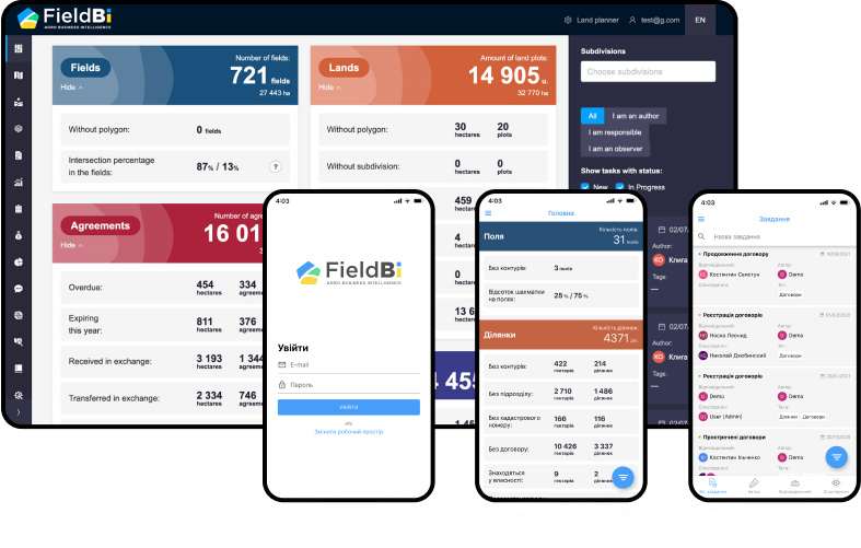
Dashboard and Mobile Apps
Comprehensive dashboard showing key metrics at a glance: 721 fields covering 27,443 hectares and 14,905 land plots across 32,770 hectares. The agreements panel tracks overdue contracts, expiring leases, and land exchanges. Mobile apps for iOS and Android give agronomists and land managers access to field data, tasks, and notifications on the go.
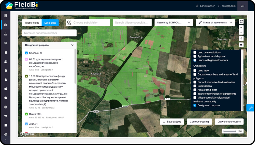
Land Valuation Map
Interactive satellite map displaying land plots colour-coded by current normative land evaluation. Filter by value ranges to instantly identify high-value parcels, compare land quality across regions, and make informed decisions about acquisitions or lease negotiations.
Agreement Expiration Tracking
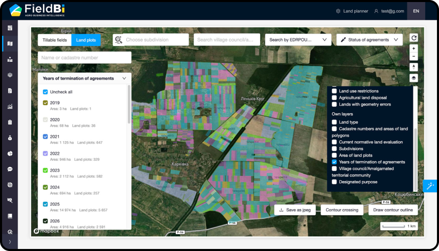
Visualise lease agreement termination dates across your entire land bank. Colour-coded by year from 2019 to 2026, this view helps land managers proactively identify expiring contracts, plan renewal negotiations, and avoid gaps in land coverage.
Land Purpose Classification
Filter and view land plots by designated purpose, including commercial agricultural production, reserve fund lands, and community territories. Understand the composition of your land bank and ensure compliance with land use regulations.
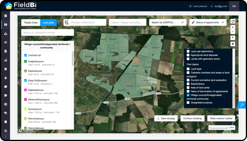
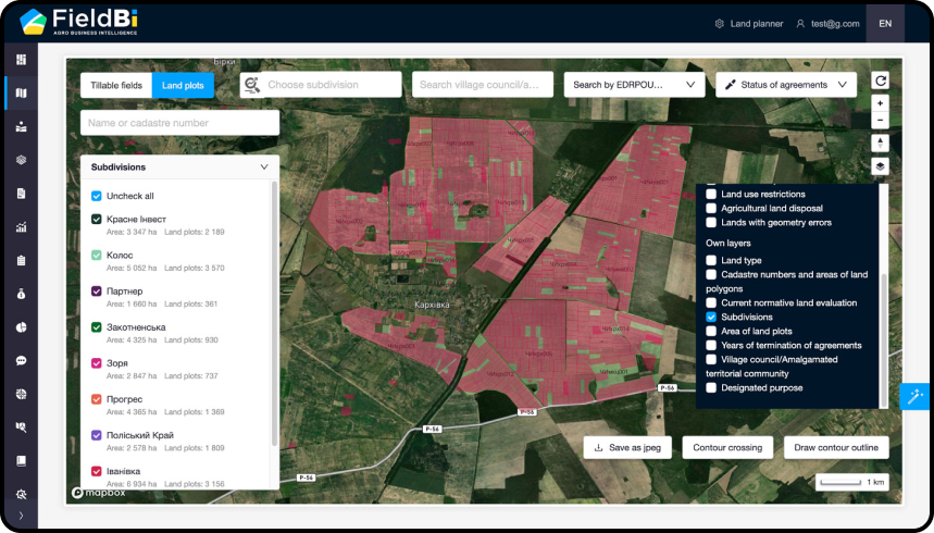
Detailed Parcel Analysis
Zoom into specific regions for detailed parcel-level analysis. View individual plot boundaries overlaid on satellite imagery, check cadastre numbers, and export map views as images for reports and presentations.
How It All Works Together
Web Application Platform
React.js frontend with Node.js backend delivering comprehensive land management features including interactive maps, analytics dashboards, and contract management.
GIS and Mapping Layer
Geographic information system integration enabling visualisation of land parcels, cultivated fields, and crop rotations on interactive maps with satellite imagery.
Mobile Applications
React Native apps for iOS and Android providing field scouting, task management, and offline capabilities for agronomists working in remote areas.
Analytics Engine
Over 20 analytical dashboards providing insights on land bank composition, contract status, financial performance, and operational efficiency.
Value and Impact Delivered
Measurable improvements across every dimension of operations.
Time to Market
Reached market 3x faster than traditional development approaches through agile methodology and proactive delivery.
Path to Profit
Product became profitable within 8 months of launch, validating the business model.
Grant Recognition
Received presidential grant from 1,000 applicants and Ukrainian Startup Fund development grant.
Market Leadership
Became the leader in agricultural land management market in Ukraine.
Customer Scale
Serves over 50 agricultural businesses managing hundreds of thousands of hectares.
Top Startup Recognition
Acknowledged as one of Ukraine's TOP-20 startups in 2020.
Ready to Transform Your Agriculture Operations?
See how AI can help your organisation reduce errors, speed up processing, and improve outcomes. Let's discuss your specific challenges.
Book Discovery CallExplore Other Projects
Discover more AI solutions delivering measurable results across industries